Post Card From Isangele
Isangele
Council is located in the Ndian Division in South West Region. It is privileged
to be among the 18 councils out of 360 with a female mayor at their helm. It is
also privileged to be located at the border, at the crossroads between Cameroon
and Nigeria. As such, its population is a melting pot of ethnicities, not only
from these two nations, but also from other West African countries attracted to
its rich fisheries.
 |
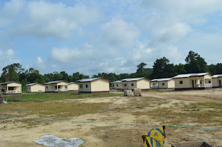
| A building scheme in Isangele: Solving the housing problem. |
Created on
june 29, 1977, this Council 765 km² Isangele Council has a population of 5,000
inhabitants and is governed by a council of 22, under the leadership of
Caroline Offiong Usim. It is bounded in the north by Mundemba council, in the
south by Kombo Abedimo council, in the west by the Atlantic Ocean and in the east by Ekondo Titi and Kombo Itindi
council areas. This is the parent council of the Bakassi Area, with offshoots
being the Kombo Itindi and Idabato Councils.
The main
settlement is Oron, with its paramount chiefdom, followed by other recognized
chiefdoms like Bateka and Amoto. Many Nigerians live in the municipality
especially in the fishing villages where in some cases they constitute up to
100% of the population.
The dominant
vegetation is the forest and over 60% of Isangele is covered by the mangrove
forest which is continually washed by creek waters from the ocean and numerous streams
and rivers. The creek
waters are excellent breeding grounds for fish. The mangrove also provides wood
for building and fuel. The water ways are used for transportation. The numerous
mangrove forests are good sites for eco-tourism but all these exist in the form
of potential. Its recent history of being the arena of warfare between Cameroon
and Nigeria, and above all, the difficult access to this area makes economic
activities other than fishing and small scale arable farming very difficult.
Over fishing is a high risk as well as destruction of the mangrove.
Potential
Any serious
talk of economic activities in Isanggele is mainly in the form of potentials.
The Council Development Plan of Isangele, designed with help from the National
Community Driven Development Programme (PNDP) cites the following as potentials
for development: agriculture due to vast expanses of fertile lands with a
sedimentary bedrock, council/community forests and timber exploitation due to
its vast primaeval and secondary forest vegetation, transport due to abundant
navigable permanent and semi-permanent waterways, commerce due to proximity to
Nigeria and Mundemba, tourism due to abundance of wild life, beaches and
islands, creeks, mangroves, etc. However, the trauma of warfare with Nigeria
needs to be buried deep in the past before such activities can reach their
golden age, and recent militant activity across the border in Nigeria do not
augur well for safety in this region, given its proximity to the hotbed of
irredentism in Nigeria. .
Council Activities and
Budget
The
Councillors met on June 21, 2016, to validate the 2015 administrative and
management accounts of the council. The meeting took place under the
supervision of the Divisional Officer for Isangele, Ngale Meende Alfred, as
representative of the Senior Divisional Officer for Ndian Division. Mayor
Caroline Offiong Usim, said the council raised 355.1 million FCFA in 2015; out
of which 326.6 million FCFA was spent on investment, leaving a surplus of 28.6
million FCFA. The investments were spent in areas such as roads,
health, pipe borne water, all in a bid to make Isangele (and in fact, the
entire Bakassi Peninsular) a more attractive place for its Cameroonian
population.
Recent Development
 |
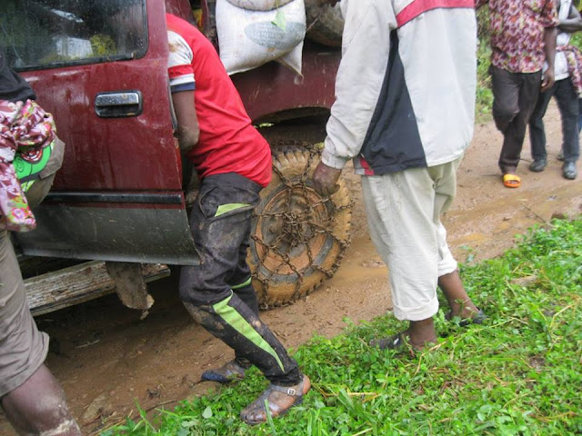
| Getting to Isangele is no feat... if you are a daredevil motorist! |


Most of those listed projects only exist on paper, apart from paving of some of the roads. I am from Isangele and I visit home regularly.
ReplyDelete